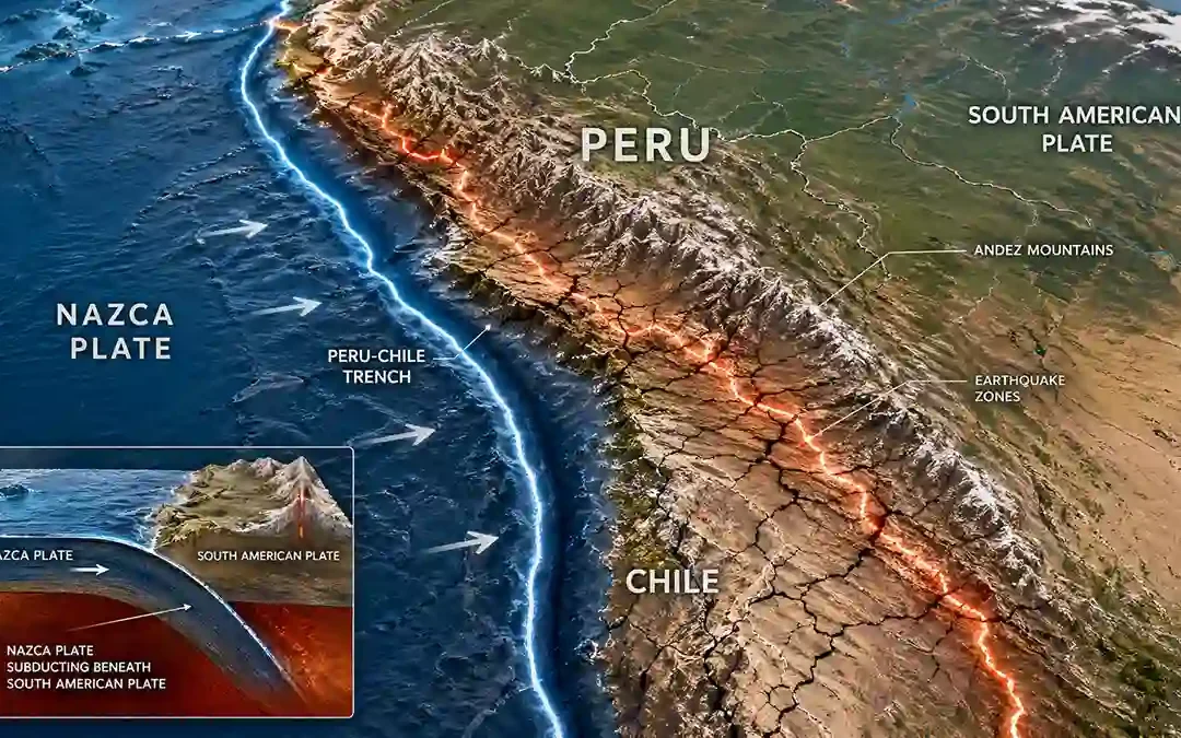
 Peru experiences earthquakes because it sits directly above one of the most active subduction zones on Earth. What makes Peru especially interesting is how closely its earthquakes are connected to the formation of the Andes Mountains. The same tectonic forces that...
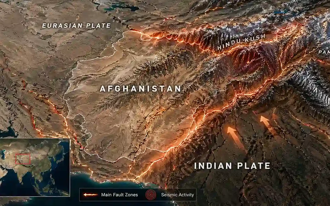 Afghanistan experiences earthquakes in a way that’s slightly different from many other countries. Here, you don’t just get shallow earthquakes — you also get deep earthquakes, especially beneath the Hindu Kush mountains. That combination makes seismic activity in...
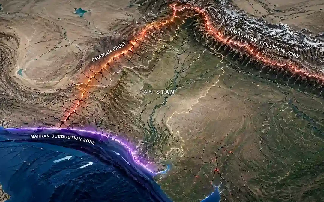 Pakistan sits at a unique geological crossroads. Instead of relying on one tectonic process, the country is shaped by three different earthquake mechanisms happening at the same time — collision, subduction, and fault movement. That’s what makes earthquakes here both...
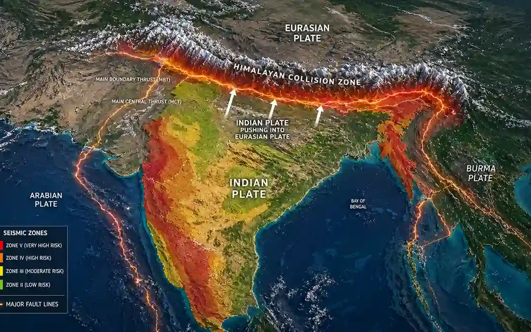 India’s earthquakes tell a story of contrast. On one side, the Himalayas are constantly under intense tectonic pressure. On the other, large parts of the country appear stable — yet occasionally produce surprising earthquakes. This mix makes India one of the most...
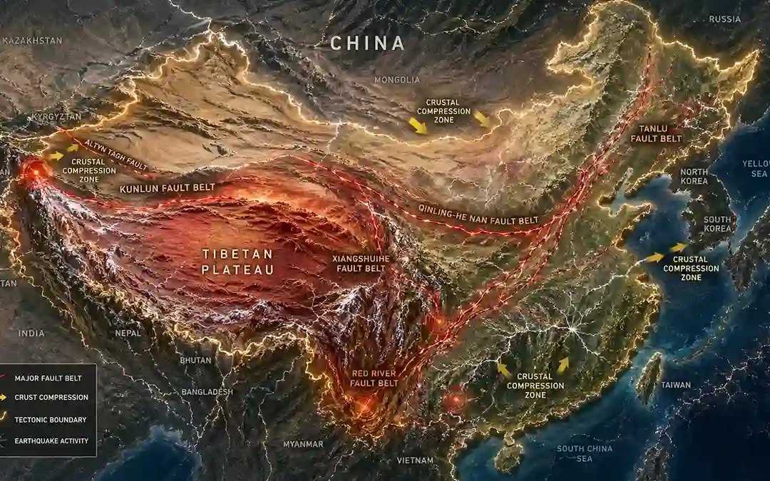 China’s earthquakes are different from what most people expect. They don’t all occur along obvious plate edges like in Chile or Indonesia. Instead, many of them happen deep within the continent, far from the ocean. That’s because China sits on a vast region where...