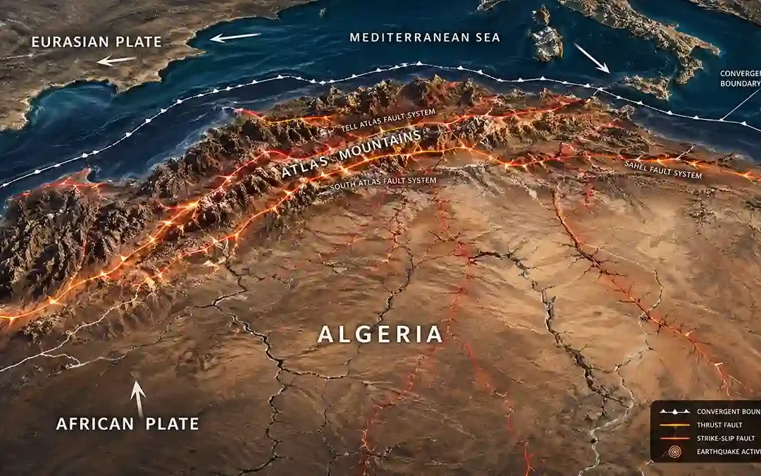
 Algeria is one of the most earthquake-prone countries in North Africa. Most of the country’s seismic activity happens in the northern regions near the Mediterranean coast, where tectonic pressure continues to shape mountain ranges and fault systems. Although...
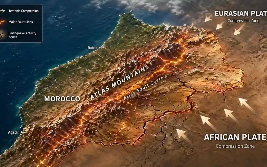 Morocco is not usually considered one of the world’s most active earthquake regions. But the country still experiences damaging earthquakes — especially near mountain regions and tectonic fault zones. What makes Morocco interesting is that its earthquakes often...
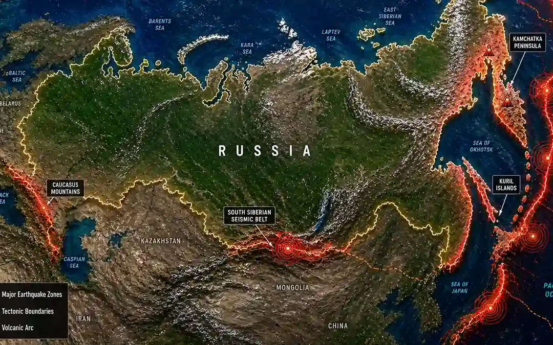 Russia is enormous — and its earthquakes are not concentrated in just one place. Some parts of Russia are extremely active and experience powerful earthquakes regularly. Other regions remain relatively stable for long periods. What makes Russia interesting is how...
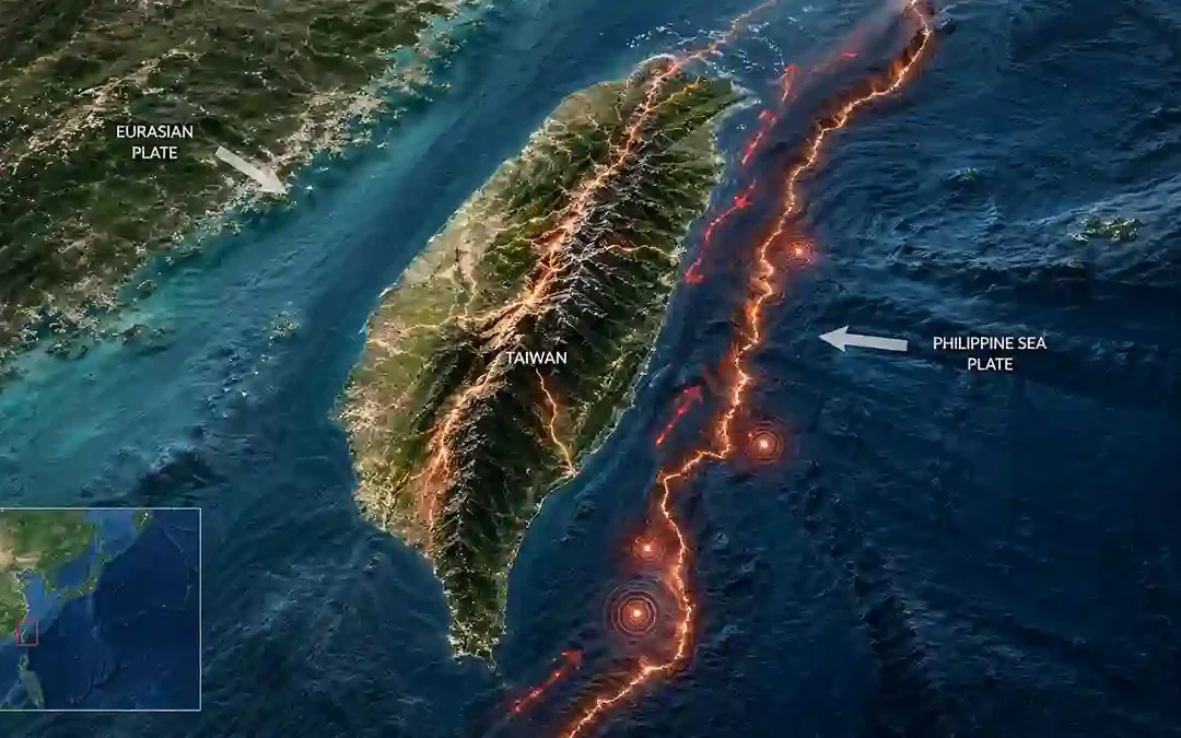 Taiwan is one of the most earthquake-active places in East Asia. The reason is simple: The island sits where two major tectonic systems collide directly beneath the surface. That collision continues to push Taiwan upward, forming steep mountains, active faults, and...
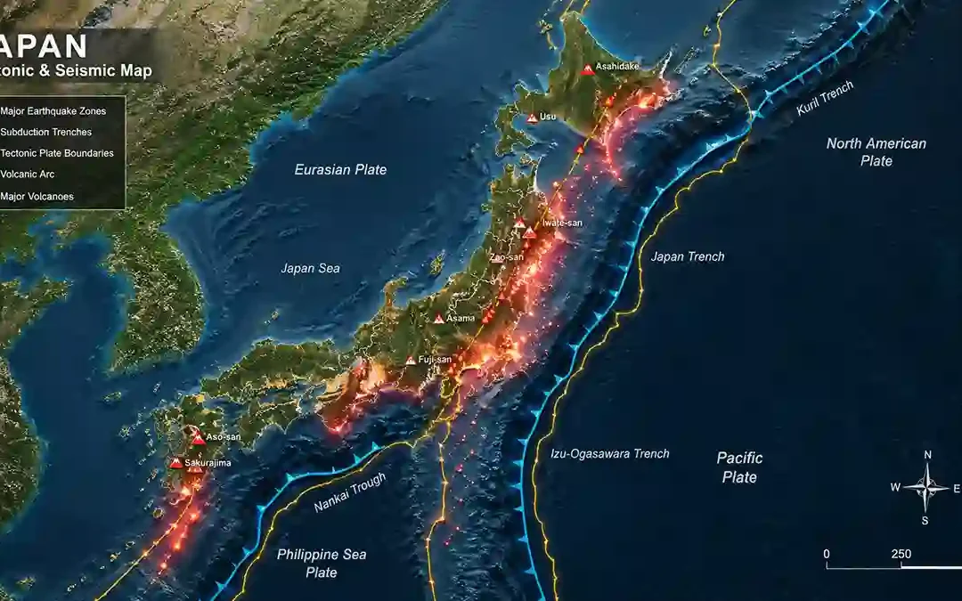 Japan is often described as one of the most earthquake-prone countries in the world. But what many people don’t realize is this: Different parts of Japan experience earthquakes for completely different reasons. Some regions are controlled by deep ocean trenches....