
Compass Clinometers: Choose the Right Tool for Geology
Compass clinometers are important tools for geological fieldwork because they help geologists measure directions and angles in the field. Depending on the instrument, they can be used to determine the orientation of rock layers, measure the dip of geological structures, assess slopes, and support geological mapping.
A traditional geological compass combines directional measurement with a clinometer for measuring vertical angles. These instruments are particularly useful in structural geology, where recording the orientation of bedding planes, joints, faults, and foliations helps researchers interpret how rocks have been deformed.
The right compass clinometer depends on the type of fieldwork you perform, the measurements you need, and the accuracy and durability required. Explore the products below, then use this guide to compare important features and choose an instrument suited to your geological work.
Best Compass Clinometers for Geological Fieldwork
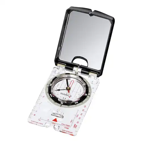
SUUNTO MC-2 Compass: Top-of-The-line Compass
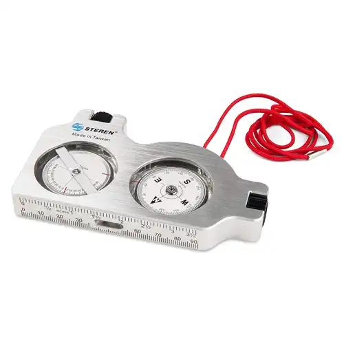
STEREN Multifunctional Surveyor Compass with Clinometer
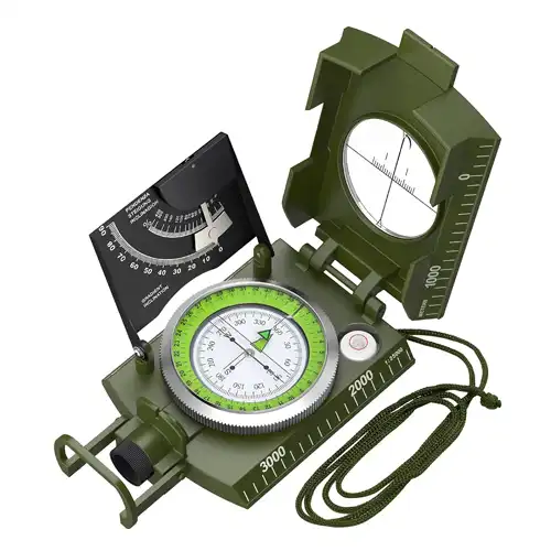
Proster Lensatic Sighting Compass IP65 Waterproof with Clinometer Bag
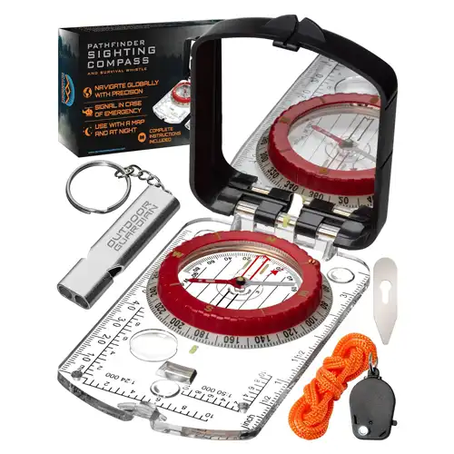
Pathfinder Sighting Compass - Precise Navigation, Hiking and Orienteering Mirror Compass
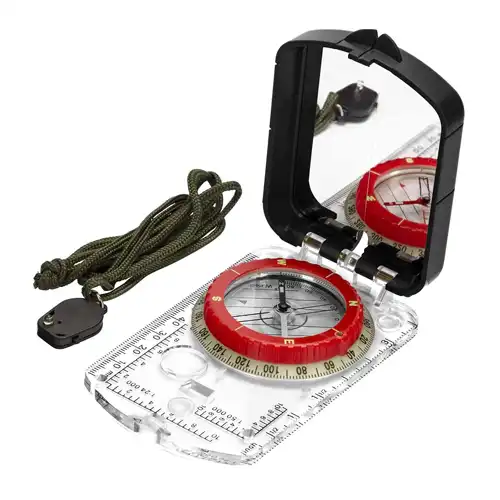
BIJIA Orienteering Map Compass -Sighting Mirror Compass with Adjustable Declination
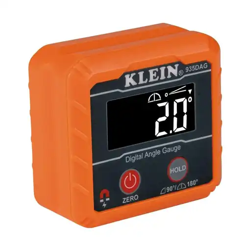
Klein Tools 935DAG Digital Electronic Level and Angle Gauge
Affiliate disclosure: As an Amazon Associate, Gelogia earns from qualifying purchases. We may earn a commission when you buy through our links, at no extra cost to you.
How to Choose a Compass Clinometer
The best instrument depends on your fieldwork, the measurements you need, and how frequently you will use it.
Compass and Clinometer Functions
A compass indicates horizontal direction, while a clinometer measures inclination or vertical angle. A geological compass clinometer combines these functions in one instrument, although the precise design varies by model.
Before buying, confirm that the instrument supports the measurements required for your work. For structural geology, you will generally want a suitable method for measuring both the direction and inclination of planar features.
Measurement Scales and Readability
Clear, well-marked scales make field measurements easier to take and record. Check whether the compass provides the directional graduations you need and whether the clinometer scale is easy to read at the angles you commonly encounter.
Some instruments use different conventions for recording orientation. Learn the manufacturer's method and your project's required notation before taking measurements.
Sighting and Alignment
Sighting features help you align the instrument with a target or geological surface. Depending on the model, these may include a sighting window, mirror, notch, or another alignment mechanism.
A good sighting arrangement can make it easier to obtain consistent measurements, particularly when examining exposed bedding planes, joints, or other geological structures.
Durability and Portability
Field instruments may encounter dust, moisture, temperature changes, and repeated handling. Look for a sturdy housing, protected moving components, a readable dial, and a design that can be carried securely in a field bag.
If you work in demanding environments, check the manufacturer's information on water resistance, operating conditions, maintenance, and storage.
Magnetic Interference and Calibration
A magnetic compass can be affected by nearby metal objects, magnetic rocks, electrical equipment, and other sources of interference. These can cause incorrect directional readings.
Check measurements away from potential interference and follow the manufacturer's instructions for calibration, adjustment, and use. If your work requires high accuracy, understand the instrument's limitations and the procedures used to verify its readings.
What Is a Compass Clinometer Used for in Geology?
Compass clinometers support several types of geological field observation. Their value lies in recording measurements that can later be compared, mapped, and interpreted.
Measuring Strike and Dip
Strike and dip describe the orientation of a planar geological feature, such as a bedding plane, fault surface, or foliation.
Strike represents the compass direction of a horizontal line on the plane. Dip describes the plane's steepest downward inclination from horizontal, together with the direction in which it slopes.
A suitable geological compass clinometer helps measure these properties so geologists can record the orientation of rock layers and compare structures across a field area. Always follow the instrument's procedure and the notation convention used for your mapping project.
Measuring Geological Structures
Field geologists examine joints, faults, folds, foliations, and other structures to understand how rocks have changed over time. Recording their orientations helps reveal patterns that may indicate deformation, tectonic stress, or relationships between rock units.
Repeated measurements across an outcrop or region can be organized into structural datasets and used to prepare maps, cross-sections, and stereographic plots.
Measuring Slope and Inclination
A clinometer can measure the inclination of suitable surfaces or terrain when used according to the instrument's design. In geology, this can help describe slopes, inclined rock surfaces, and certain geological features.
However, the angle of a hillside is not necessarily the dip of a nearby rock layer. Measure the intended surface carefully and record exactly what the reading represents.
Compass Clinometer vs. Regular Compass
Although both instruments provide directional information, they are not interchangeable for every geological task.
| Feature | Regular compass | Compass clinometer |
|---|---|---|
| Horizontal direction | Yes, depending on design | Yes, when the model includes a compass |
| Inclination measurement | Not normally included | Included |
| Strike and dip fieldwork | Requires an additional angle-measuring method | Suitable models support these measurements |
| Slope measurement | Not normally available | Available when supported by the clinometer design |
| Typical use | Navigation and directional bearings | Geological orientation measurements and other angular observations |
A basic compass may be sufficient for navigation, but structural geology often requires an instrument that can measure both direction and inclination. Check the specifications of the individual model rather than relying on the product category alone.
How to Use a Compass Clinometer in the Field
Correct technique is essential for obtaining useful measurements. Always follow the instructions for your specific instrument because procedures differ between designs.
- Choose the feature to measure. Identify the bedding plane, joint, fault surface, or other feature you want to record.
- Check the surroundings. Move away from nearby metal objects and possible magnetic interference where practical.
- Align the instrument correctly. Place or sight it against the intended geological surface according to the manufacturer's procedure.
- Measure the orientation. Use the compass and clinometer functions as appropriate to obtain the required directional and angular readings.
- Record the result immediately. Write down the measurement, location, field-station number, feature type, and any relevant observations.
- Check consistency. Repeat the measurement when appropriate, especially if the surface is rough, irregular, or difficult to align with.
- Review the notation. Make sure the recorded strike, dip direction, and dip angle follow the convention required by your project.
Accurate fieldwork depends on more than the instrument itself. Surface selection, alignment, magnetic interference, and consistent recording procedures can all affect the quality of the final dataset.