by Gelogia Team | Apr 28, 2025 | Physical Geology
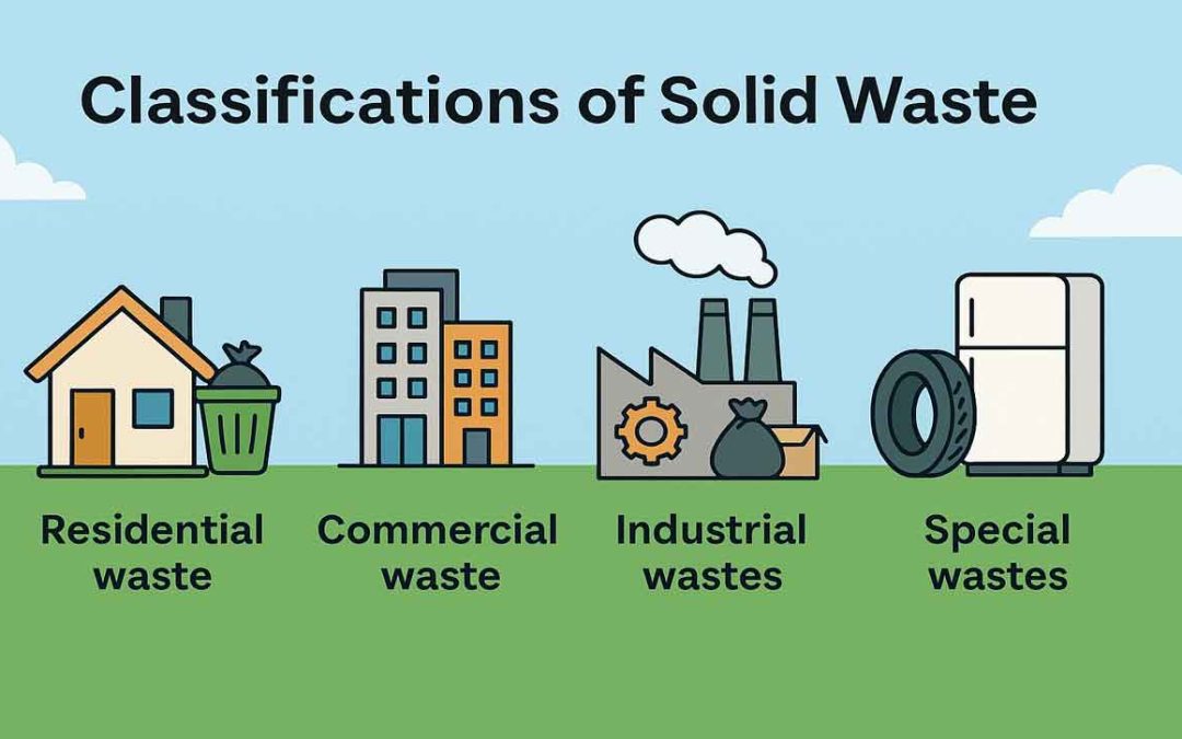
Municipal solid waste (MSW) typically refers to solid or semi-solid discarded materials resulting from industrial, commercial, agricultural, institutional, and residential operations, but does not include solids or dissolved materials in industrial or domestic sewage...
by Gelogia Team | Apr 27, 2025 | Physical Geology
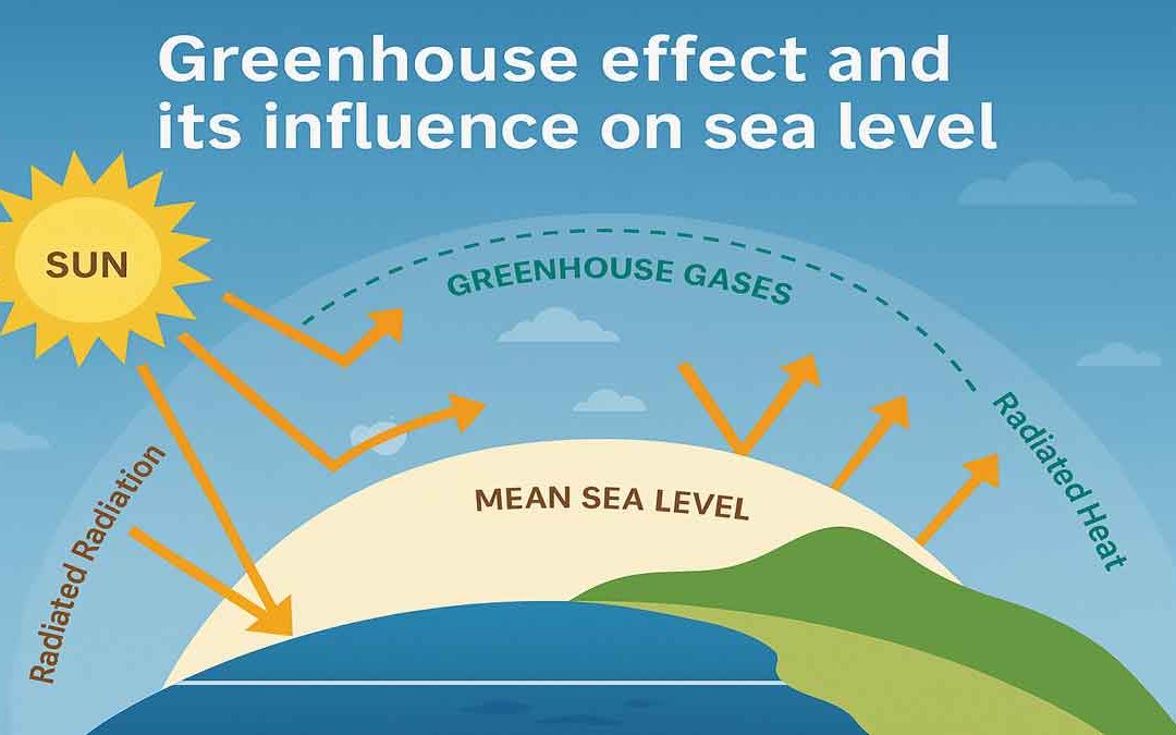
There are some gases that absorb infrared radiation (IR) from the sun and radiate heat in all directions. These gases are called greenhouse gases. Greenhouse gases in the Earth’s atmosphere absorb IR from the sun and release it. The Greenhouse Effect: Both solar heat...
by Gelogia Team | Apr 23, 2025 | Physical Geology
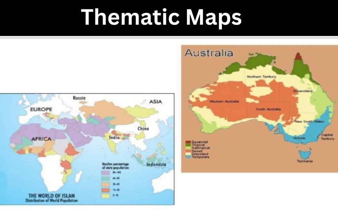
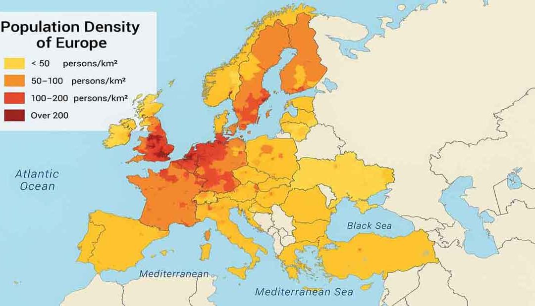
Thematic maps present geographic data through visual techniques, allowing patterns, distributions, and relationships to emerge clearly. They effectively communicate complex spatial information using color, symbols, and density representations. Types of Thematic Maps:...
by Gelogia Team | Apr 21, 2025 | Physical Geology
Thematic maps are especially designed to show a particular theme connected with a specific geographic area. They can portray physical, social, political, cultural, economic, sociological, agricultural, or any other aspect of a city, state, region, nation, or...
by Gelogia Team | Apr 20, 2025 | Physical Geology
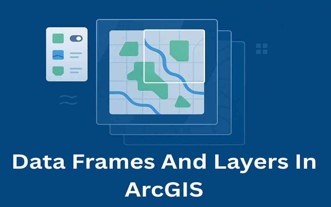
In ArcGIS, data frames and layers are essential for organizing and displaying map data. They help manage how geographic information is viewed, styled, and analyzed on a map. Data Frames: In ArcGIS Desktop, data frames are an element of the ArcMap user interface that...
by Gelogia Team | Apr 19, 2025 | Physical Geology
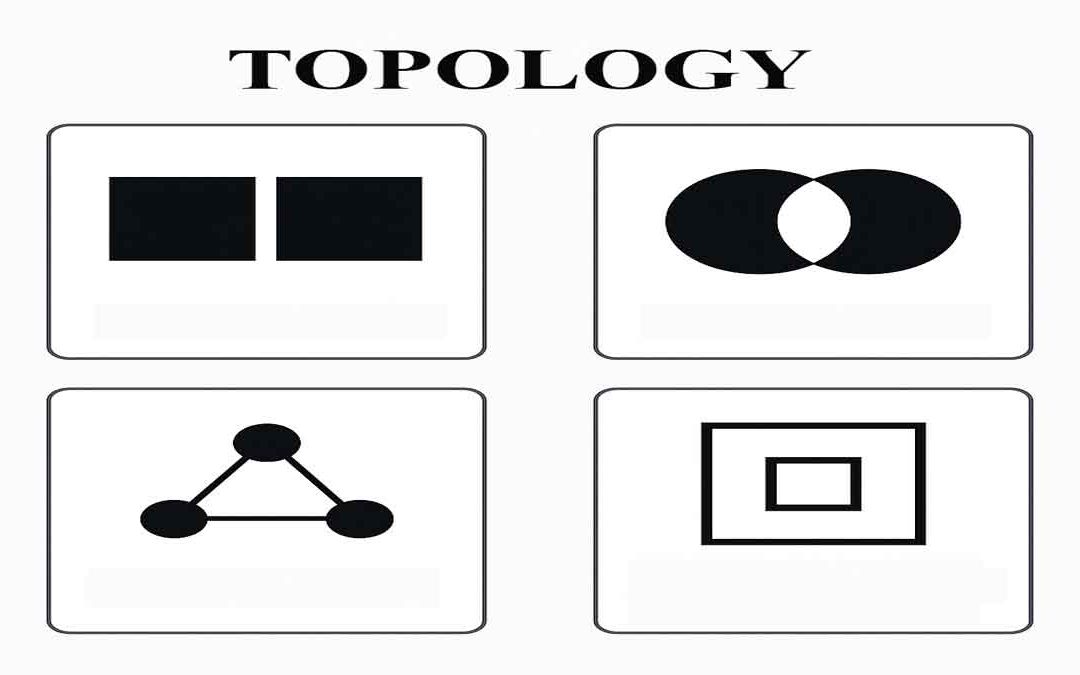
Topology defines the process to describe and maintain the spatial relationships of map features. Function of topology: It allows the function on the basis of the following aspects: Adjacency Coincidence Connectivity Containment and others A GIS topology is a set of...