Thematic maps are especially designed to show a particular theme connected with a specific geographic area. They can portray physical, social, political, cultural, economic, sociological, agricultural, or any other aspect of a city, state, region, nation, or continent.
Application of thematic maps:
- Some map products offer a mechanism for comprehensive geographic data analysis and are typically more valuable. These specialized maps, called thematic maps, utilize user selection and the benefits of a GIS to offer a unique, yet comprehensive, description of the focal geographic terrain.
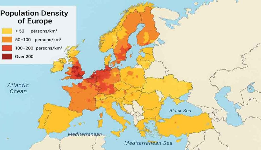
- A thematic map is defined as a specialized map that depicts the spatial distribution of one or more explicit themes. These map themes portray dataset attributes and can detail anything quantifiable. Such as population density, income distribution, crime, natural resources, water distribution, pipelines, and disease occurrence. GISs are used to manipulate, analyze, and convey geospatial information.
- Thematic maps offer the GIS user a better way to understand the geographic area in focus, as well as an excellent means to inform others.
- A GIS offers users an easy method to manipulate specific data attributes through the application of thematic layers. A layer is a set of theme-based data that is described and stored in a map’s data library.
- Location-based thematic maps are ideal for estimating distances. These maps contain data specifically tied to geographic locations, making it straightforward to calculate the distance between two points. Moreover, the spatial data presented in these thematic maps assists in understanding the relationship between the two locations.
- When exploring a particular topic, cartographic tools can be incredibly effective. Thematic maps focus solely on a specific research subject. The spatial data gathered through this approach offers essential insights needed for creating thorough documentation.