
GPS and Measuring Equipment for Geological Fieldwork
GPS devices and measuring equipment help geologists record where observations occur, measure geological features, and document relationships between rocks and landforms. These tools are essential for geological mapping, field surveys, mineral exploration, structural geology, and the collection of scientific data.
A handheld GPS receiver can help record the coordinates of an outcrop or sample location, while measuring tapes and digital calipers provide dimensions of rock layers and specimens. Laser distance meters, surveying instruments, and other positioning tools can support more specialized field investigations.
The best equipment depends on the scale of your work, the accuracy you need, and the conditions in which you collect data. Explore the products below to compare GPS devices and measuring tools for geology students, researchers, field mappers, and professional geologists.
Best GPS and Measuring Equipment for Geology
A well-chosen field kit helps geologists collect organized, repeatable measurements and connect observations to their correct locations. The equipment you need depends on whether you are recording sample coordinates, measuring rock specimens, documenting outcrops, or conducting a geological survey.
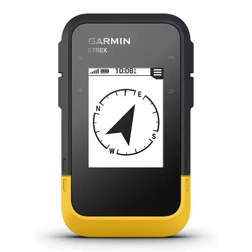
Garmin eTrex® SE, GPS Handheld Navigator
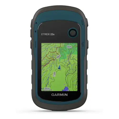
Garmin 010-02256-00 eTrex 22x, Rugged Handheld GPS Navigator
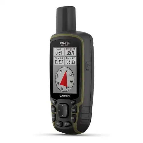
Garmin GPSMAP 65s, Button-Operated Handheld with Altimeter and Compass
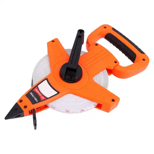
Amazon Basics Open Reel Fiberglass Measuring Tape 30M
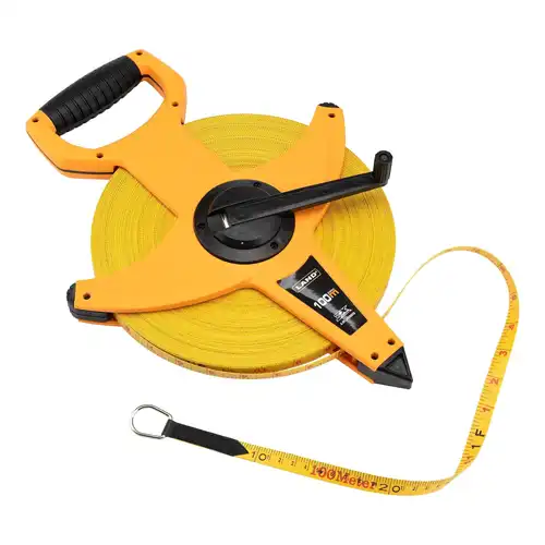
LAND 330FT/100M Heavy Duty Fiberglass Tape Measure
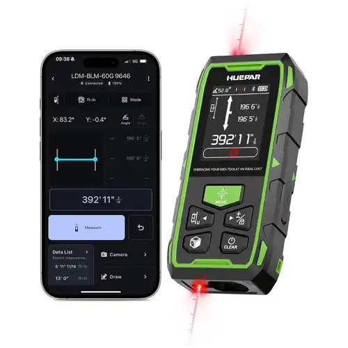
Huepar 2026 Upgraded Dual Laser Distance Meter, 395Ft
Affiliate disclosure: As an Amazon Associate, Gelogia earns from qualifying purchases. We may earn a commission when you buy through our links, at no extra cost to you.
GPS Devices for Geological Fieldwork
GPS devices help geologists associate observations with geographic locations. Accurate location records make it easier to revisit outcrops, map rock units, organize sample collections, and combine field data with geographic information systems.
Handheld GPS Receivers
A dedicated handheld GPS receiver is designed for outdoor navigation and location recording. Depending on the model, it may support waypoint storage, route recording, mapping, and coordinate export.
When choosing a device, consider screen readability, battery life, map compatibility, storage capacity, durability, and ease of transferring recorded data to a computer. Check which satellite positioning systems the device supports and whether its accuracy is suitable for your work.
Smartphone GPS and Mapping Apps
Smartphones can record coordinates and display digital maps, making them convenient for students and fieldworkers who already carry a phone. Mapping apps may also allow users to save points, attach photographs, and organize field observations.
However, phone positioning accuracy varies with the device, satellite visibility, terrain, and surrounding conditions. Battery life, connectivity, and environmental protection can also limit use in remote locations.
High-Accuracy GPS and GNSS Equipment
Projects requiring precise positioning may need specialized GNSS receivers, differential positioning, or real-time kinematic methods. These systems can achieve substantially better accuracy than ordinary handheld navigation devices when correctly configured and used under suitable conditions.
Their performance depends on equipment quality, satellite visibility, correction data, antenna setup, and survey procedures. For professional surveys, confirm the instrument's specifications and the accuracy requirements of the project before purchasing.
Geological Measuring Instruments
Different measuring instruments are designed for different tasks. Choosing the correct tool helps ensure that recorded dimensions and angles are meaningful.
Digital Calipers and Rulers
Digital calipers measure the dimensions of rock samples, fossils, and mineral specimens within their measuring range. Rulers are useful for simpler measurements and can provide a scale reference in specimen photographs.
When comparing calipers, consider their range, stated accuracy, resolution, jaw design, and resistance to dust or moisture. A display with more decimal places does not automatically guarantee greater measurement accuracy.
Measuring Tapes
Measuring tapes are useful for measuring distances across outcrops, recording exposed layer thicknesses, and documenting dimensions that exceed the range of a small ruler or caliper.
In stratigraphic work, distinguish between the distance measured along an exposed surface and the true thickness of a geological layer. Inclined bedding and uneven terrain can affect the relationship between these measurements.
Compass Clinometers
Compass clinometers combine directional measurement with angle measurement when the instrument is designed to provide both functions. They are commonly used to record the orientation of bedding planes, faults, joints, and foliation.
These instruments are particularly important in structural geology. Nearby metal objects and magnetic materials can affect compass readings, so users should follow the instrument's instructions and check for possible interference.
Laser Distance Meters
Laser distance meters can measure distances to suitable targets without requiring a tape to extend between the observer and the target. They may be useful for accessible outcrops and certain field survey tasks.
Their effectiveness depends on the model's range, target surface, lighting, and line of sight. They are not automatically suitable for measuring every irregular geological surface or every type of survey distance.
How to Choose GPS and Measuring Equipment
The best instrument depends on the measurements you need, the environment in which you work, and the accuracy required for your project.
Accuracy and Measurement Range
Check the manufacturer's stated accuracy, measurement range, and operating conditions before purchasing. For GPS equipment, distinguish between typical positioning accuracy and the higher accuracy possible with specialized survey methods.
For measuring tools, understand the difference between resolution, accuracy, and repeatability. A device that displays a fine measurement increment may still have a larger measurement error than expected.
Battery Life and Data Storage
GPS receivers and digital instruments rely on batteries, so runtime matters during long field sessions. Consider spare batteries, charging options, internal storage, removable memory, and how recorded data can be exported.
Before fieldwork, test the device and confirm that you can retrieve and back up your data.
Durability and Weather Resistance
Field equipment can encounter rain, dust, mud, heat, and rough handling. Choose devices with protection appropriate to the expected conditions and verify the manufacturer's weather-resistance specifications.
Protect screens, optical surfaces, measuring jaws, and moving components during transport. Even rugged instruments require proper handling and maintenance.
Mapping Compatibility and Data Management
For GPS devices, check whether recorded waypoints and tracks can be exported in formats compatible with your mapping software or GIS workflow. Coordinate reference systems and units should be consistent throughout a project.
For measuring instruments, establish a clear procedure for recording measurements alongside field-station numbers, sample identifiers, dates, and locations. Good data organization is essential for later analysis.
Which Equipment Is Best for Different Geological Tasks?
| Geological task | Recommended equipment | Main purpose |
|---|---|---|
| Recording outcrop locations | Handheld GPS or suitable positioning device | Store geographic coordinates |
| Geological field mapping | GPS, compass clinometer, field notebook | Record locations and structural observations |
| Measuring small specimens | Digital caliper or ruler | Record sample dimensions |
| Measuring exposed rock layers | Measuring tape or suitable survey tools | Document distances and layer thicknesses |
| Measuring strike and dip | Geological compass clinometer | Record the orientation of planar features |
| High-accuracy positioning | Appropriate GNSS survey equipment | Support projects requiring precise coordinates |
| Measuring suitable target distances | Laser distance meter | Measure distances within the instrument's capabilities |
These tools complement one another. A GPS receiver records where a feature is located, while a caliper or measuring tape records its dimensions. A compass clinometer measures orientation, which provides a different type of information.
How to Record Reliable Geological Field Measurements
Reliable geological data requires suitable equipment, consistent measurement techniques, and clear records.
- Identify the measurement objective. Decide whether you need a geographic coordinate, length, thickness, angle, elevation, or specimen dimension.
- Choose the appropriate instrument. Confirm that its measurement range and accuracy suit the task.
- Check the equipment. Inspect the instrument, verify its condition, and complete any required zero checks or calibration procedures.
- Record the location. Use a consistent coordinate system and record the field-station or sample identifier.
- Use a consistent method. Position the instrument correctly and measure the intended feature.
- Record units and context. Include the date, measurement units, relevant geological observations, and instrument details where needed.
- Review and back up the data. Check entries for missing units or inconsistent coordinates and preserve digital records.
These practices make field observations easier to compare, map, and interpret after returning from the field.