by Gelogia Team | Jun 7, 2026 | Mineralogy
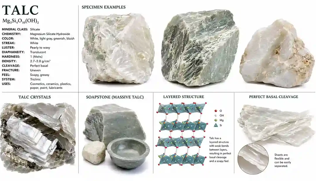
Talc is the softest known mineral and serves as the standard for hardness value 1 on the Mohs Hardness Scale. It is a magnesium-rich silicate mineral recognized for its extremely soft feel, greasy texture, and ability to be scratched easily with a fingernail. Talc is...
by Gelogia Team | Jun 7, 2026 | Mineralogy
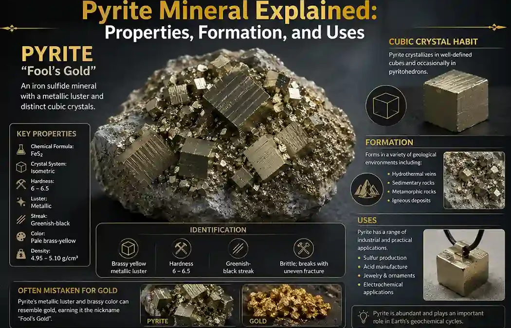
Pyrite is one of the most recognizable minerals in the world because of its bright metallic appearance and gold-like color. Often called “Fool’s Gold,” pyrite has fooled prospectors for centuries into thinking they had discovered real gold. Despite...
by Gelogia Team | Jun 7, 2026 | Mineralogy
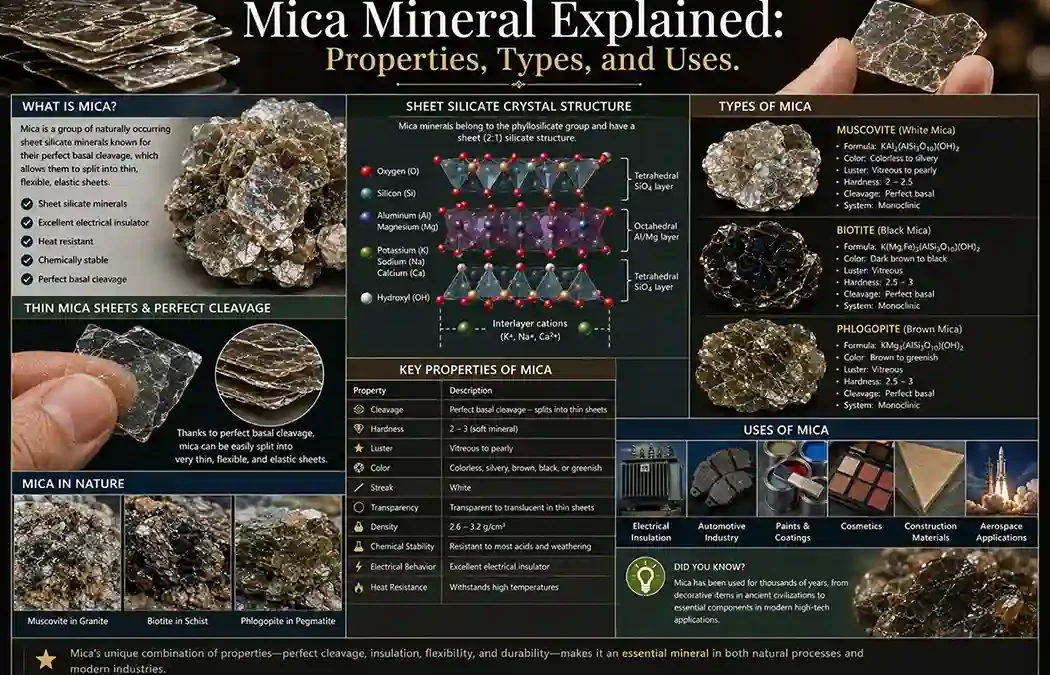
Mica is a group of important rock-forming silicate minerals known for their perfect basal cleavage and ability to split into extremely thin, flexible sheets. Mica minerals are common in: igneous rocks metamorphic rocks sedimentary rocks Because of their distinctive...
by Gelogia Team | Jun 6, 2026 | Mineralogy
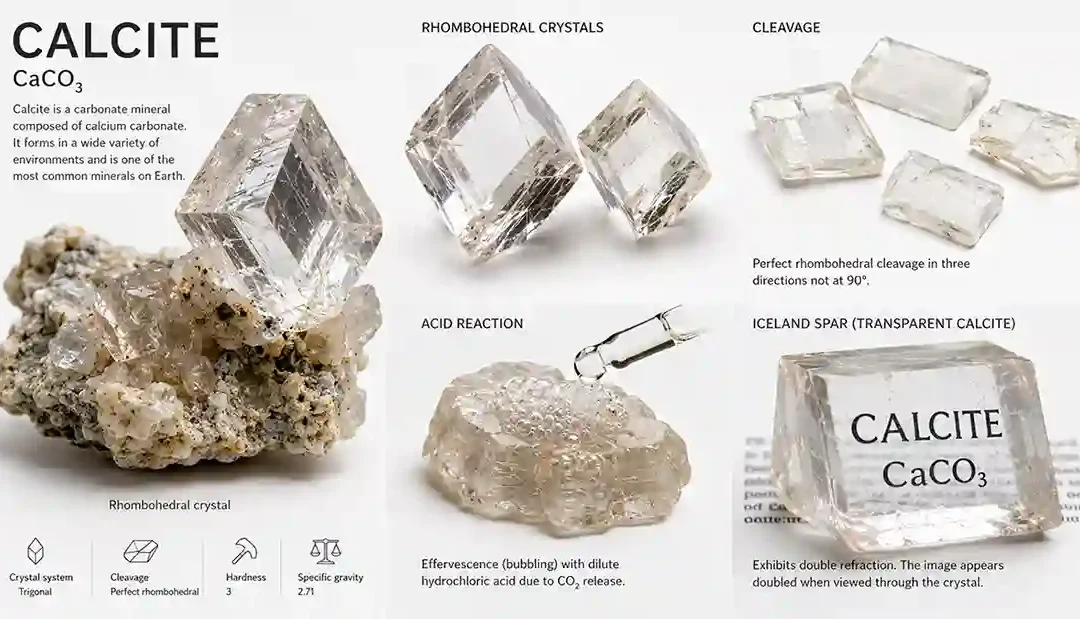
Calcite is one of the most common and important minerals on Earth. It is the primary mineral found in limestone and marble and plays a major role in sedimentary, metamorphic, and biological processes. Composed of calcium carbonate, calcite is widely recognized for its...
by Gelogia Team | Jun 6, 2026 | Mineralogy
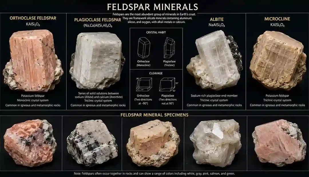
Feldspar is the most abundant mineral group in Earth’s crust, making up approximately 50–60% of many rocks. These minerals are essential components of igneous, metamorphic, and sedimentary rocks and play a major role in understanding geological processes....