by Gelogia Team | Jul 16, 2025 | Physical Geology & Geomorphology, Structural Geology
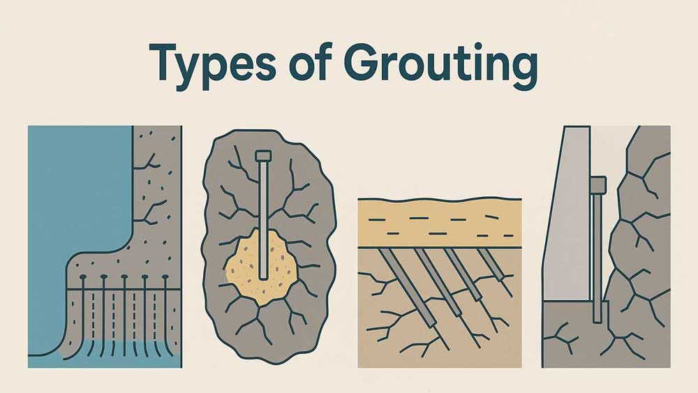
Grouting plays a crucial role in geotechnical engineering by improving the strength, stability, and impermeability of soil and rock foundations. Engineers inject a fluid-like material into voids, cracks, or porous zones to seal, consolidate, or reinforce the ground....
by Gelogia Team | Jul 14, 2025 | Physical Geology & Geomorphology, Structural Geology
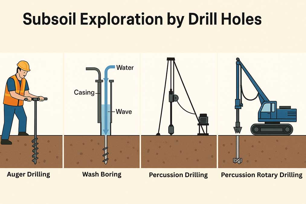
Subsoil exploration helps engineers understand what lies beneath the ground surface before starting any construction work. It identifies different soil layers and their properties. One of the common ways to explore subsoil involves drilling holes using methods such as...
by Gelogia Team | Jul 12, 2025 | Physical Geology & Geomorphology, Structural Geology
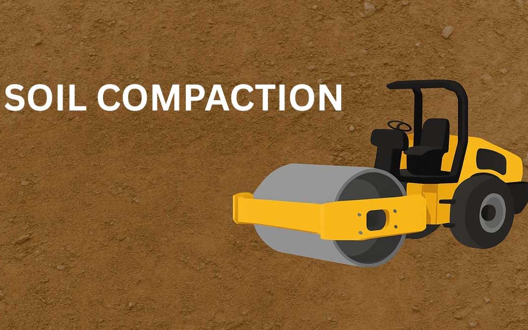
Compression soil accomplished by loading for a short period is known as compaction. It is a quick process of densification and stabilization of soil. A soil mass loses its compactness when it is excavated from its natural source and deposited elsewhere. Why Soil...
by Gelogia Team | Jul 11, 2025 | Crystallography & Mineral Optics, Physical Geology & Geomorphology
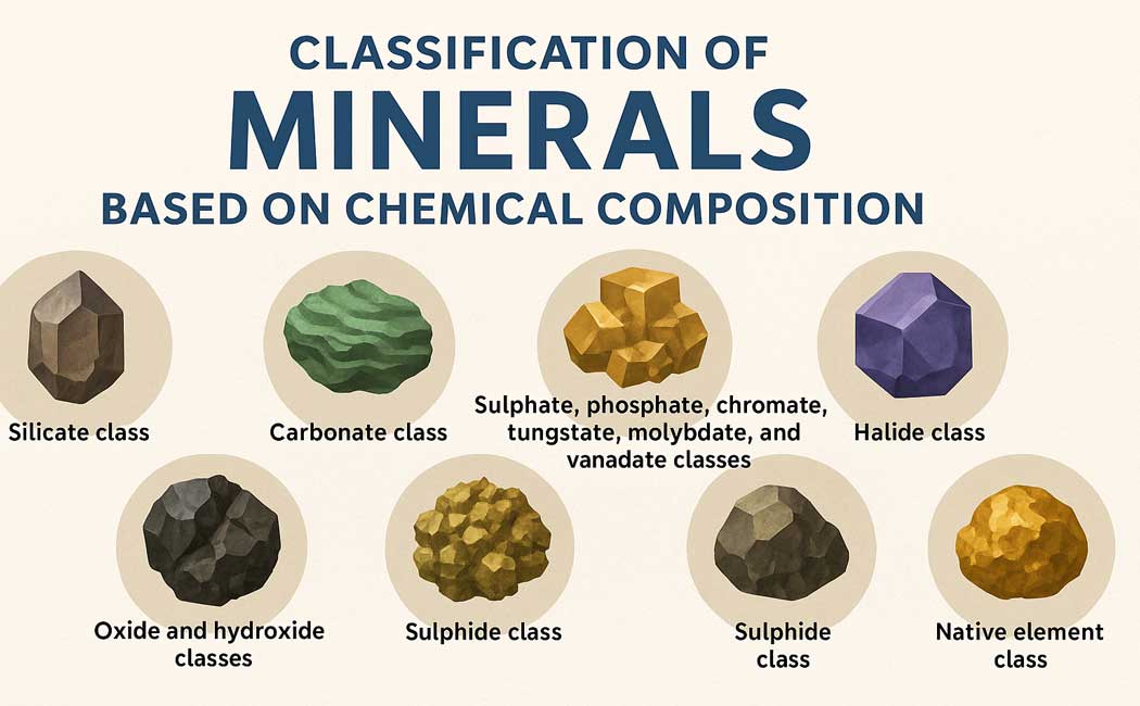
The classification of minerals is primarily based on their chemical composition, which allows scientists and geologists to systematically organize them into distinct groups. Minerals may be classified based on their chemical composition. They are grouped and described...
by Gelogia Team | Jul 10, 2025 | Mineralogy, Physical Geology & Geomorphology
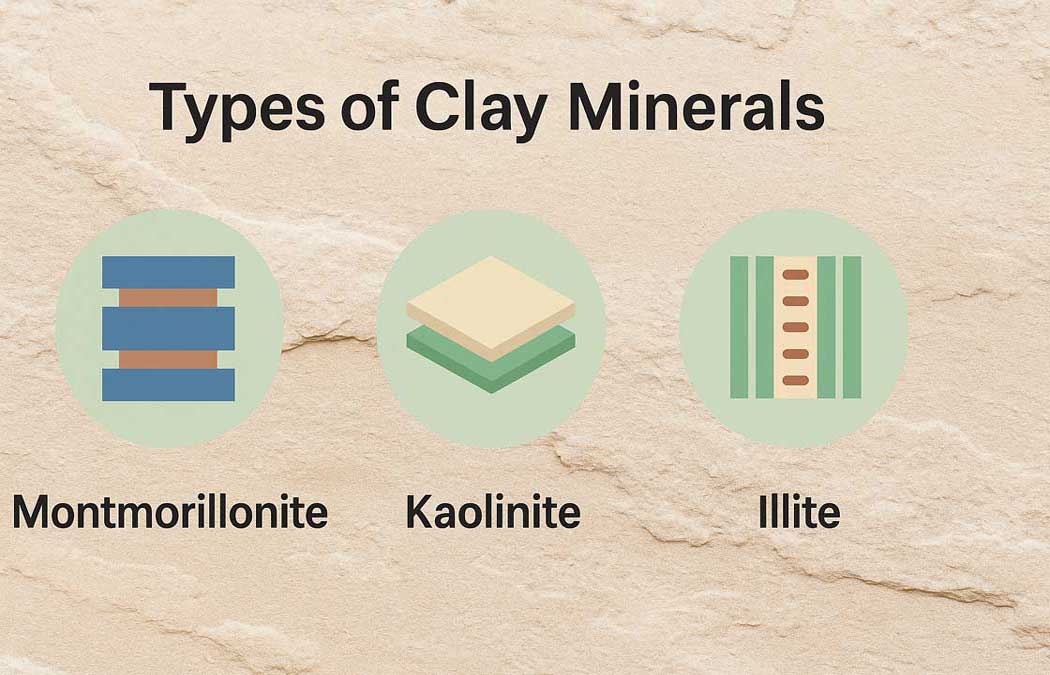
Clay minerals consist of crystalline materials that give soil its plasticity and cohesion. A clayey soil, along with non-clay minerals like quartz, feldspar, mica, and calcite, often includes one or two clay minerals made of microscopically thin sheets. Chemically,...
by Gelogia Team | Jul 9, 2025 | Physical Geology & Geomorphology
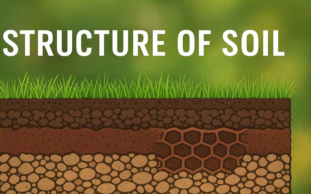
The structure of soils is the arrangement of the constituent particles in the soil matrix that contains voids, fissures, and cracks. Soil structure depends on many factors such as shape, size, mineral composition, orientation of the grains, the relation of soil water...