Latest Post & Case Study
Recent Post
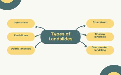
Types of Landslides
Landslides are powerful natural events where soil, rock, and debris suddenly move downhill. They can be slow or...
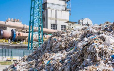
Operations and Maintenance of Waste-to-Energy (WTE) Facilities
The O&M of Waste-to-Energy (WTE) facilities requires special consideration and operator skills. WTE facilities are...
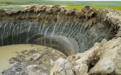
Permafrost: Where It’s Found and the Different Types
What is permafrost? Permafrost is a condition where a layer of soil, sediment, or rock below the ground surface...
Mineralogy & Petrology
No Results Found
The page you requested could not be found. Try refining your search, or use the navigation above to locate the post.
Geology & Earth Science
No Results Found
The page you requested could not be found. Try refining your search, or use the navigation above to locate the post.
Paleontology
No Results Found
The page you requested could not be found. Try refining your search, or use the navigation above to locate the post.
Solar System
No Results Found
The page you requested could not be found. Try refining your search, or use the navigation above to locate the post.