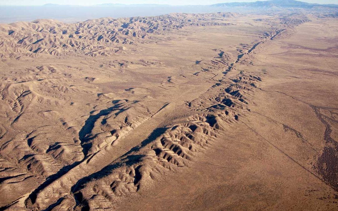
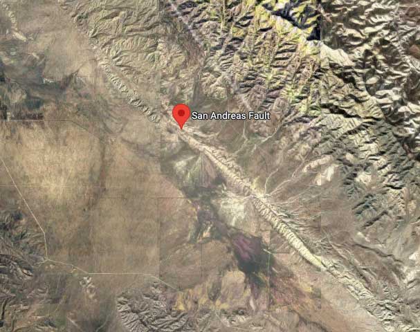
The San Andreas Fault is one of the most well-known geological features in the world, running approximately 800 miles through the state of California, USA. This fault line has captured the fascination of scientists, geologists, and the public alike due to its significant role in shaping the landscape and its potential for seismic activity. In this article, we will delve into the intricacies of the San Andreas Fault, its formation, and its impact on the region, offering a comprehensive understanding of this remarkable geological phenomenon.
Understanding the San Andreas Fault:
The San Andreas Fault is a major right-lateral strike-slip fault, characterized by the horizontal movement of tectonic plates. It forms the boundary between the Pacific Plate and the North American Plate, two massive sections of the Earth's crust. This fault's unique motion gives rise to earthquakes as the plates grind past each other, releasing accumulated stress in the form of seismic energy.
Formation and Evolution:
The formation of the San Andreas Fault can be traced back millions of years. It originated as a result of the complex tectonic forces that have shaped the western edge of North America. The movement along the fault has occurred gradually, resulting in the displacement of rocks, formation of mountains, and the creation of the remarkable landscape we see today.
The Role of Plate Tectonics:
Plate tectonics play a pivotal role in the existence and behavior of the San Andreas Fault. The movement of the Pacific Plate relative to the North American Plate is responsible for the ongoing seismic activity in the region. Understanding the mechanics of plate tectonics helps us predict and prepare for future earthquakes, contributing to public safety and urban planning.
Seismic Activity and Earthquakes:
The San Andreas Fault is synonymous with seismic activity, and the potential for large earthquakes is a constant concern. Historical records show significant earthquakes along the fault, including the infamous 1906 San Francisco earthquake. These seismic events have shaped the development of earthquake monitoring systems and have led to ongoing research aimed at better understanding earthquake prediction and preparedness.
Geological Features Along the Fault:
The San Andreas Fault is not just a line on a map; it has created fascinating geological features throughout its length. From the stunning Carrizo Plain to the iconic Coachella Valley, the fault's influence on the landscape is evident. The formation of valleys, mountains, and rifts showcases the powerful forces at work beneath the Earth's surface.
Studying the Fault:
Scientists and geologists have dedicated significant efforts to studying the San Andreas Fault. Through seismic monitoring, geodetic measurements, and field observations, researchers aim to gain insights into fault behavior, stress accumulation, and the potential for future seismic events. Such studies help inform hazard assessments, emergency planning, and infrastructure design in earthquake-prone areas.
Conclusion:
The San Andreas Fault stands as a testament to the dynamic nature of our planet and the profound influence of plate tectonics. Its history, formation, and ongoing seismic activity continue to capture the attention of scientists and the public alike. By understanding the San Andreas Fault, we not only gain valuable insights into Earth's geology but also enhance our ability to mitigate the potential impacts of future earthquakes. So, let us marvel at the wonders of this geological phenomenon while prioritizing safety and preparedness in the face of its seismic activity.