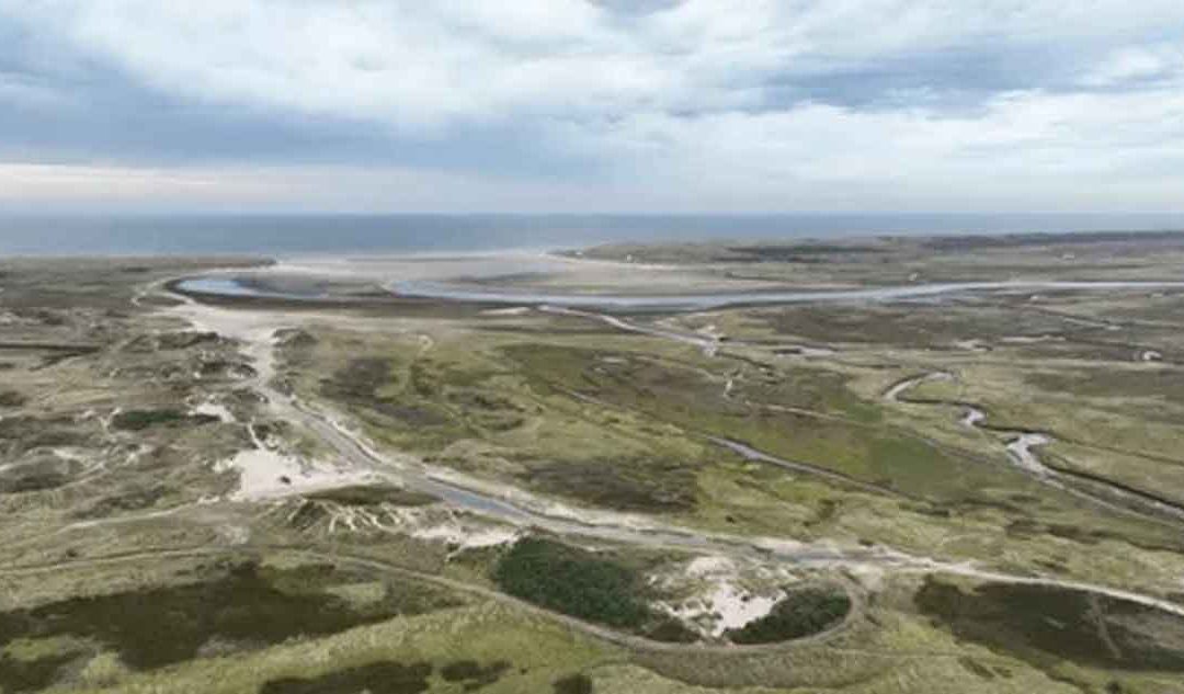
Coastal Plain:
A coastal plain is a flat, low-lying piece of land adjacent to the coast. It is free from wave action. Coastal plains are separated from the rest of the interior by nearby land areas, such as elevated upland or hillocks and mountains.
The land surface of the coastal plain is very close to the mean sea level (MSL) and sometimes rises only about a few meters above sea level and dips less than one degree. The primary reason for the flat nature of the coastal plain is the unconsolidated sediments that are the "bedrock" of the region.
The Eastern coastal plain refers to a wide stretch of landmass of India, lying between the Eastern Ghats and the Bay of Bengal. It is wider and flatter than the western coastal plains and stretches from Tamil Nadu in the south to West Bengal in the north through Andhra Pradesh and Orissa.
In western South America, the Andes Mountains and the Pacific Ocean surround a large coastal plain. In the United States, you can find coastal plains along the Atlantic Ocean and the Gulf of Mexico.
In the Netherlands and Belgium, the North Sea shaped coastal plains along its edge. Some coastal plains begin as continental shelves—flat pieces of land lying below sea level. When sea levels fall, they expose this land, forming coastal plains. These plains can sometimes stretch far inland.
Coastal Plain Subdivisions:
The coastal plain is subdivided into three sub-environments:
- Subtidal zone
- Intertidal zone
- Salt marsh
1. Subtidal Zone
The subtidal zone is the area below the low tide level. The subtidal zone is a relatively shallow part of the sea above the drop-off of the continental shelf, representing a neritic zone and a part of the coastal plain, lying below the low tide level. Since sediments come from the sea, coarser sediments (sands) settle down there.
2. Intertidal Zone
The intertidal zone is the area that lies between high tides and low tides (Tidal Flat: sand flat, mixed flat, and mud flat). Above the subtidal zone toward the land, there is a flat surface, inundated twice a day during the high tide.
During low tide, the water exposes the area. It lies between the high and low tide levels. The intertidal flat or zone is also known as the foreshore or seashore and is sometimes referred to as the littoral zone. Starfish, sea urchins, and various types of coral reefs inhabit different habitats in this area.
The intertidal or tidal flat can be subdivided into three sub-zones:
i) sand flat (seaside) - sand dominated area of tidal flat;
ii) mixed flat (middle portion) - sand and clay dominated area, and
iii) mud flat (land side) - mud dominated area of tidal flat.
3. Salt Marsh (Supratidal Zone)
The area floods during spring tide, storm periods, tidal waves, and tidal surges, creating a salt marsh. The supratidal zone does not normally receive saline or brackish water. The supratidal zone only receives water during spring tide, tidal surges, tsunamis, or storm periods.
Mangroves grow in the supratidal zone. All these zones shift landward when the sea level rises (marine transgression) and move seaward during the fall of the sea level (marine regression). Hence, the vertical succession of tidal flats has alternation of sand, sand-silt-clay, or muddy sequences.
The rise and fall of sea level changes the sedimentary facies in the vertical sequence of coastal plain stratigraphic sections. Holocene tidal sequences do not have enough time to become aerially exposed. Hence, the sediments remain unconsolidated.