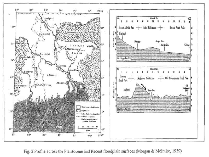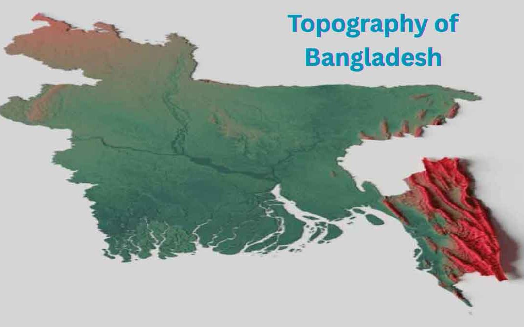
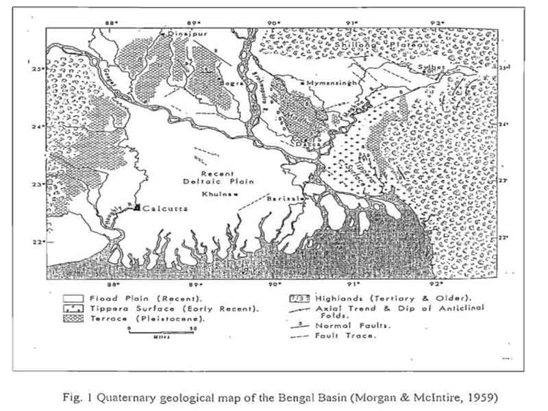
Bangladesh, a South-East Asian country, is located at the lowermost reaches of the Bengal Basin. The Quaternary sediments (began about 2 million years ago and extend to the present), deposited mainly by the mighty rivers—the Ganges, Brahmaputra, and Meghna—cover about three-quarters of Bangladesh (Fig. 1). About half of its surface lies below the 10-meter contour line.
This shows how the topography of Bangladesh is shaped predominantly by riverine action and sedimentation.
Approximately 10% of the land consists of Pleistocene sediments with an average elevation of more than 15 meters above sea level (Banglapedia, 2000). The Pleistocene uplands in Bangladesh are divided into three blocks:
a) Lalmai hills,
b) Madhupur tract, and
c) Barind tract.
These three upland zones display distinct topography types, each possessing unique characteristics. For example, geographers observe five kinds of relief patterns: level areas, poorly-drained zones that cover much of the Barind Tract and parts of the Madhupur Tract, high uplifted lands such as the 15-meter-high western edge of the Barind Tract, broadly dissected zones found mostly on the Madhupur Tract, and closely dissected valleys.
In addition, a north-south elongated low hill range, the Lalmai hills stretch about 16 km in length and 2–3 km in width, covering an area of 33 sq km. Deeply incised valleys separate some hilltops, which feature flat, table-like surfaces. Furthermore, a topography survey of this region reveals a near-perfect dendritic drainage pattern.
Similarly, geologists identify the Madhupur Tract, a significant upland region in central Bangladesh, as a terrace that rises 1 to 10 meters above the adjacent floodplains. It spans around 4,244 sq km, and faults seem to have superficially divided it.
Moreover, extensive dissection has shaped the tract into narrow and broad valleys, once again forming a dendritic drainage system. In geography, topography plays an essential role in understanding this landscape, as it reveals the geological processes and erosion that have occurred over time.
Finally, the Barind area, located in central Old Bengal, spans approximately 7,680 sq km. It features six north-south elongated, isolated reddish-brown highlands. The drainage pattern here is almost trellis-like, a feature well-documented in many world maps, with topography resources highlighting South Asian terrain.
Many people wonder, 'What is topography in geography?' Simply put, geographers study and map the surface features of the land, including elevation, slope, and landform structures. In Bangladesh, this topography directly influences local ecosystems, shapes land use, and impacts the climate..
Speaking of climate, it’s important to note how topography affect climate—upland areas often experience different rainfall patterns compared to the surrounding plains due to elevation and airflow changes.