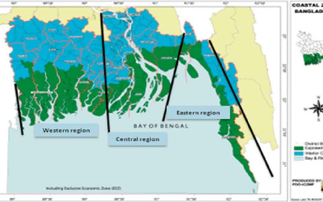
Depending on the geomorphological features, the coastal region of Bangladesh can broadly be divided into the following three regions:
The Eastern Region:
The eastern coastline of Bangladesh, from the big Feni River to Badar Mokam (the southern tip of the mainland) along Chittagong, forms a ‘Pacific Type’ coast. It runs parallel to the young (Tertiary) folded hill ranges. Sand makes up almost 90% of its composition, while the rest consists of silt and clay.
The Central Region:
This region extends from the Tetulia River to the Big Feni River estuary, including the mouth of the Meghna River up to the confluence of the Padma (Ganges-Brahmaputra) and the Meghna River near Chandpur. Sand makes up 10% of it, while silt and clay constitute 70%.
The Western Region:
The coastline westward from the Tetulia River to the international boundary at the Hariabangha River lies in the western region. Dense mangrove forests with deeply scoured tidal channels dominate the region, where the tidal plain overlaps the abandoned Ganges delta. Alluvium soil almost entirely composes the area.